Tuesday, July 12, 2016

Three Fingered Jack Loop Hike, OR

The first real backpack trip since before I had kids! Thanks to a push from a good friend and a supportive spouse who stayed behind with the kids I was able to spend 3 days and 2 nights exploring a beautiful part of the Jefferson Wilderness in the Deutsches area. I am proud to say that I was far more organized before children and found I had done a stellar job cleaning and packing away all my backpacking gear 5 years ago, so everything was in great shape.

I would not call the Three Fingered Jack Loop (20.5 miles) an easy hike at all. It has some more advanced degrees of difficultly but it is worth it for the absolute beauty and uniqueness of the area. We started with an easy 5 miles or so on the first day which took us through a rather beautiful young second growth ecosystem recovering from a fire that surged through the area in 2003.

We camped in a beautiful meadow. It was raining but that wasn't the best surprise of the first night. At some point during the night our tent and one backpack were attacked by a very vicious creature with sharp teeth and amazing sense of smell for granola bars, commonly known as a chipmunk.
 Hole chewed by a chipmunk (aka chomper)!

The second day was clear with a partial overcast. The weather forecast for the third day was rain again so we decided to put down as many miles as possible before the second storm rolled in. We went off trail following a stream through meadows of wildflowers.
 Paintbrush growing in meadow along stream

The stream began to shrink as we climbed in elevation until coming to a snowy mountain ridge that we climbed up and over to get back onto the trail. This climb up and over was by far the most challenging part of the hike.
Climb down from ridge back to trail

Once we were back on the trail it continued in elevation but had some spectacular views along the way as we hiked along.
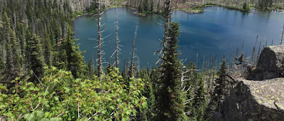
Looking down on Wasco Lake

We continued to hike through many patches of snow before setting up camp, finishing out the day with approximately 11.5 miles hiking (we felt like bad asses). 

Crossing one of many sections snow cover trail

We decided that we deserved a fire. After collecting wood and much effort we finally got a fire started.
Do not ever start a fire like this...seriously!

It rained that night again. We had wet gear, frozen hands and were almost out of water, so we were very grateful that we only had 4 or so miles all downhill to our vehicle. We hiked out into a cloud so we did not get any views of 3 Fingered Jack but all the views of the prior day still had us feeling good.
Foggy view on hike out

Lessons learned: 1) Remove all food from tent and pack and secure it before sleeping! 2) Collect water at every opportunity 3) Bring fire starting supplies 4) Keep smiling!


Monday, January 6, 2014

Back in action! Hoyt Arboretum!

I was not prepared to writing about this hike so this entry is brief. It has been awhile, but two kids and a dog later we are back to hiking! Easier kid and dog friendly hikes are now the goal. For our first hike after the birth of our second daughter who is 12 weeks old, we picked a local easy dog friendly hike through Hoyt Arboretum. The Arboretum has a large network of trails the lead throughout the Washington Park area with 1,400 different tree species. The even provide bags for dog poop along the way. Parking as of January 10th will cost $1.60 an hour throughout Washington Park, including the zoo lot. There are many trail heads but we like to start from the visitors center.

This time of year I recommend sticking to the evergreen tree trails. There is not much happening on the Maple Tail right now. Most trails are jogging stroller friendly. Hiking with a toddler and dog is slower than what I use to do but lots of fun and everyone is asleep in the car before you get home. I hope there will be more hikes to come.

Sunday, May 29, 2011

Angel's Rest Trail, OR

The Columbia River Gorge National Scenic Area has some spectacular views and trails. Angel's Rest Trail is one of those views and trails. This trail is 4.4 miles out and back and is right off of The Columbia Gorge Historic Scenic Highway west of Multnomah Falls.  It is a 1,400 foot climb from the parking lot to Angel's Rest. The view from the top is well worth the climb on a clear day. Be sure to pack water and lunch to enjoy with your view from the top.

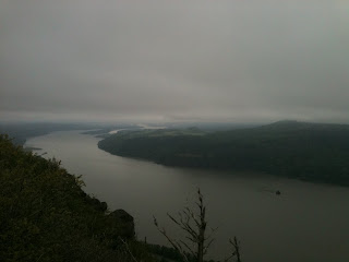
View looking west from Angle's Rest

This is also the perfect time to catch the early spring time flowers along the trail. In full bloom are Menzies' Larkspur (Delphinium menziesii), Chocolate Lilies (Fritillaria lanceolata), Pacific Bleeding Heart (Dicentra formosa) and many others. For wildflower buffs this is just the beginning of the season in the Columbia Gorge.

 Chocolate Lily (Fritillaria lanceolata)

 Menzies' Larkspur (Delphinium menziesii) line the trail


Monday, May 9, 2011

Ozette Triangle Trail, WA

The Ozette Triangle Trail is a gorgeous 9 mile loop and part of the Olympic National Park north of Forks, WA. The trail splits at the parking lot and is 3 miles to Cape Alava and 3 miles to Sand Point, camping is allowed at both locations. There is 3 miles of beach connecting Cape Alava and Sand Point creating the 9 mile triangle.
The 3 mile beach portion of the trail is a very unique section of Pacific Ocean beach with historic and sacred ties to the Makah Tribe. About 1.5 miles the down the beach are petroglyphs carved into Wedding Rock by the Ozette People between 300 and 500 years ago. The site of the Ozette Village is about 14 miles south of Neah Bay on the Pacific Ocean side of the Olympia Peninsula.

This trail was teaming with wildlife. There was everything from deer to coyotes to birds. Best of all the native Banana Slug!
The only campfires allowed are driftwood fires at the Cape Alava campground. All overnight camping requires a permit of $5 plus $2 for each person and $15 a vehicle. Overnight hikers are required to keep all food and garbage in bear cans, which are available at the Port Angeles and Quinalt Ranger Stations.

We camped at Cape Alava after hiking 3 miles in the first day. This gave us plenty of time to hike the 3 mile beach portion at a low tide on the second day and the last 3 miles from Sandy Point back to the parking lot. The rain and moisture on the first night made it impossible to start a campfire, despite all of Cody and Matt's efforts. However the following day was sunny and beautiful. The Cape Alava Campground was a lush green meadow where one might expect a gnome to appear running across it. This hike is in my top 10 favorite hikes.

Cape Flattery, WA

Cape Flattery is the most northwestern point in the lower United States. Recently renovated by the Makah Tribe, it is a one mile hike to a beautiful view point of Tatoosh Island. Parking permits are $10 a car and can be purchased at the local grocery store/gas station. Dogs are allowed on this trail.

 This view point is an excellent spot to look for Puffins. Our groups was able to spot two Puffins and a loud group of Sea lions.
 Tatoosh Island
South of the view point

Friday, January 7, 2011

Playa Carricitos, Sayulita

Today we went to Playa Carricitos. We followed a dirt road north out of Sayulita through the cemetery and turned left up a dirt road before Playa de Los Muertos and followed hand painted signs to Playa Carricitos.  This beach usually has fairly mellow waves for body surfing, but today was a bit rough due to a small storm the day before. We went with a couple from our hotel, Shyla and Max, and met a very friendly beach dog. The beach dog we named Coco made herself at home on our beach towels and ran off with Shyla's shoe. Luckily Cody convinced Coco to trade the shoe for a stick. The waves were very fun to play in and Cody turned a nice reddish pink color. This beach had very little traffic and we had it all to ourselves.

Playa Carricitos

Beach dog "Coco"

Dirt road to Playa Carricitos

Thursday, January 6, 2011

Playa de Los Muertos, Sayulita

Today we visited Playa de Los Muertos which translates into The Beach of the Dead. Most likely named for the cemetery you walk through to get to the beach. The cemetery is very large and maintained by family members. The beach is also a popular spot for Mexican families and maintained by the city. It was a fairly short hike compared to our hike to Playa Malpasos, but a wonderful taste of Mexican culture. There are three main extended Mexican families that make up a large part of the 2000 full time residents in Sayulita.

 This is the Cemetery

 The Beach of the Dead